
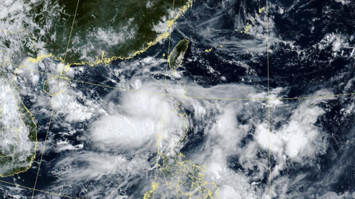
TAIPEI (TVBS News) — Weather forecasters across Taiwan are tracking a developing low-pressure system in the Bashi Channel (巴士海峽) that could strengthen into Tropical Storm Danas (丹娜絲) by Friday (July 4). The system threatens to unleash powerful winds and torrential rainfall across the island nation this weekend, with meteorologists urging residents to brace for potentially hazardous conditions.
Wu De-romg (吳德榮), a prominent meteorologist, reported that the European Centre for Medium-Range Weather Forecasts model forecasts clear, scorching conditions across Taiwan on Friday (July 4), with intense ultraviolet radiation requiring protective measures. Wu emphasized that the storm's most severe impact will occur between Saturday and Sunday morning, before conditions begin improving Sunday afternoon, though forecast models remain subject to revision.
Taiwan's Central Weather Administration (CWA, 氣象署) confirmed that the low-pressure system churning in the Bashi Channel possesses the potential to develop into a tropical storm, creating a significant threat to the island. Wu also revealed that a second tropical disturbance is gradually forming northwest of Luzon Island and could intensify into a storm upon entering the South China Sea (南海), with projections showing it may traverse the Taiwan Strait (台灣海峽) on Saturday (July 6).
Wu emphasized the critical importance of monitoring forecast trajectories closely, citing significant uncertainties regarding the system's formation location and changing wind patterns that guide storm movement. The meteorologist noted that the Global Ensemble Forecast System model shows similar trajectory variations, with most scenarios placing the disturbance east of Taiwan, necessitating ongoing scrutiny of forecast modifications. ◼