
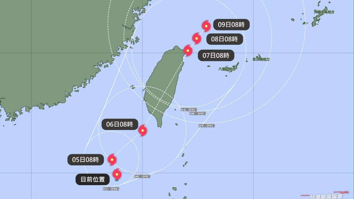
TAIPEI (TVBS News) — A tropical system continues gaining strength in the Bashi Channel as local meteorological experts warn it could intensify to the upper threshold of a moderate typhoon, Danas (丹娜絲). The Taiwan Typhoon Forum (TWTYBBS, 台灣颱風論壇|天氣特急) reported on Friday (July 4) that the system currently positions itself on the western side of the Bashi Channel and the northern South China Sea. Weather specialists are closely monitoring the storm's development as it approaches Taiwan's vicinity.
The forum anticipates that the storm will execute a sharp northeastern turn on Saturday (July 5), dramatically accelerating its forward movement. The storm could either pass through the Taiwan Strait or traverse northern Taiwan's western regions from Sunday (July 6) afternoon through Monday (July 7) morning. TWTYBBS noted that following overnight consolidation, the tropical system has significantly improved its structural organization and is expected to become typhoon Danas, marking the fourth named storm of the year.
Weather forecasters acknowledge a less probable scenario where the storm could cross southern Taiwan before tracking northward along the eastern coastline. The forum emphasized that the storm's trajectory remains highly uncertain, with greater clarity expected by Saturday (July 5) afternoon. Rainfall will commence in southern and eastern regions on Saturday, intensifying and expanding as the storm enters the Taiwan Strait on Sunday, necessitating heightened vigilance across the entire island.
The local forum warned that the most severe wind and rainfall conditions could occur from Sunday through Monday. Weather experts urgently advise residents to utilize Friday (July 4) for comprehensive storm preparations and ensure all necessary safety measures are properly implemented. ◼