
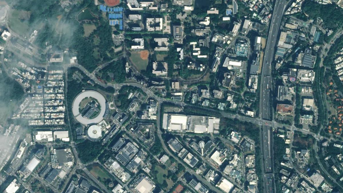
TAIPEI (TVBS News) — National Space Organization (國家太空中心, TASA) has unveiled the first images captured by the Formosat-8 first satellite on Wednesday (Feb. 11), showcasing areas such as Hsinchu Science Park (新竹科學園區), Tainan Anping (台南安平), Kaohsiung Xing-Da Fishing Harbor (高雄興達港), Tokyo's National Stadium, and Barcelona Airport. The satellite, which launched in late November last year, began its official imaging mission in January after rigorous testing.
TASA reported that the satellite's images meet the U.S. military's Image Interpretation Resolution Standards, with raw resolution at 1 meter and post-processed images improved to 0.7 meters. The clarity and signal-to-noise ratio surpass the original design specifications. The images reveal clear details of Tainan Anping's fishing boat trails and Kaohsiung Xing-Da Fishing Harbor's water textures, successfully capturing Tokyo's National Stadium and Barcelona Airport.
Wu Cheng-wen (吳誠文), Chairperson of TASA, emphasized that Formosat-8 marks Taiwan's significant step into the international space industry, proving the nation's capability in independently developing satellites and components. Dr. Wu Jong-shinn (吳宗信), TASA's Director General, highlighted the eight-year effort to enhance resolution from 2 meters to 1 meter, with more precise optical payload design and stringent satellite stability requirements.
Cynthia Liu (劉小菁), the mission's principal investigator, confirmed the mission's success in achieving 1-meter resolution optical satellite capability, moving towards sub-meter resolution. These images can assist in precision agriculture and environmental monitoring. Chi Ting-huan (齊廷洹), son of the late director Chi Po-lin (齊柏林), expressed awe and emotion at the satellite's initial results, anticipating further collaboration with TASA to document Taiwan's significant landscapes and events.