



Taiwan faces unpredictable Typhoon Champi through the weekend
TAIPEI (TVBS News) — Taiwan is bracing for the worst overnight as Typhoon Champi's (薔琵) massive wind field engulfs the island, with forecasters warning the storm may slow or spin erratically near the northeast coast, prolonging the danger window into Saturday morning.
The moderate typhoon's center was approximately 220 kilometers (137 miles) southeast of Yilan County (宜蘭縣) as of 1:15 p.m. Friday (Oct. 23), Taiwan's Central Weather Administration (中央氣象署) reported. Its wind field — averaging 320 kilometers (199 miles) in radius — now covers nearly thn
"The period from this evening through tomorrow morning is when the impact will be most significant," CWA forecaster Wu Wan-hua (伍婉華) said Friday. She warned the storm may exhibit "irregular movement, including spinning" near the northeast coast, a pattern that has extended previous typhoons' impact by hours or even days.
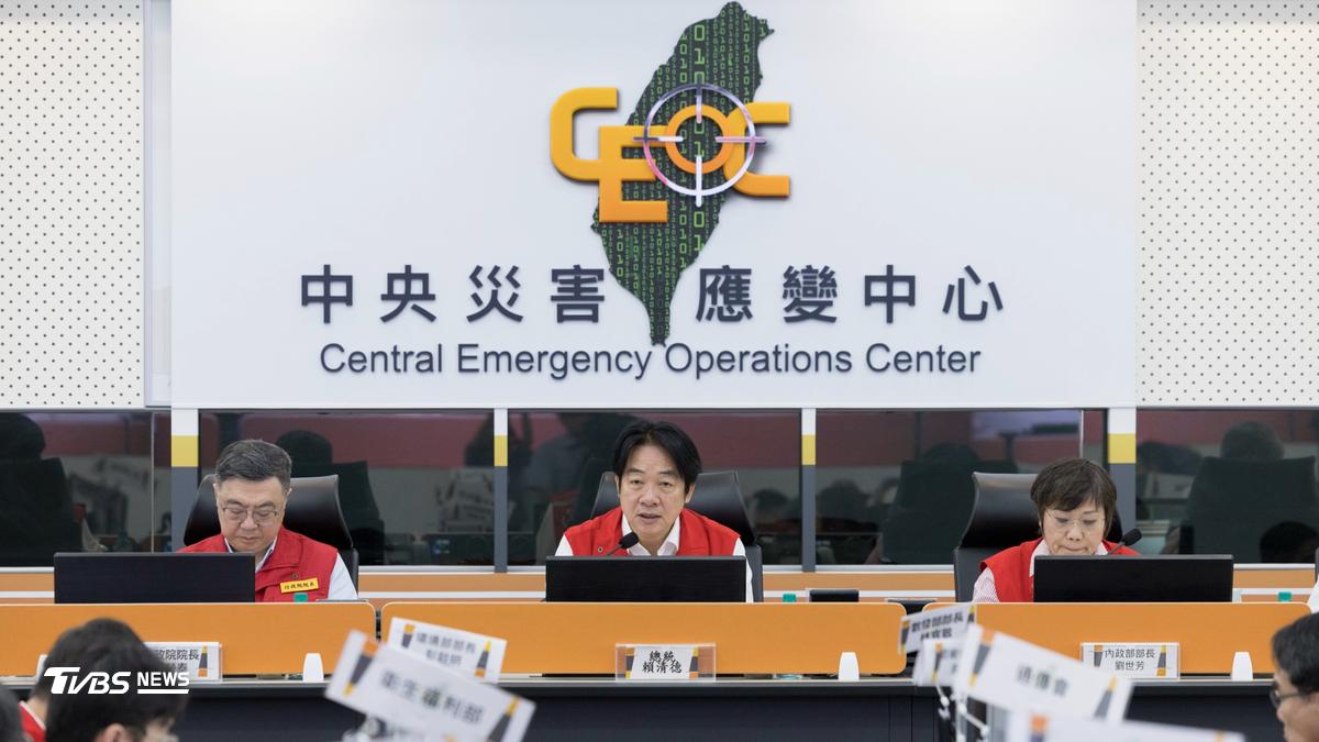
Visiting the Central Emergency Operations Center (中央災害應變中心) Friday morning, President Lai Ching-te (賴清德) issued a blunt directive: "Close roads if needed; evacuate if needed; we absolutely cannot let our guard down." He ordered priority evacuations for elderly residents, those with mobility limitations, and people with medical needs to be completed before nightfall.
The CWA issued its highest rainfall alert — "super heavy rain," meaning more than 500 millimeters (20 inches) in 24 hours — for the mountainous northeast. Taipingshan (太平山莊), a mountain resort at 1,950 meters (6,400 feet) elevation, had already recorded 450 millimeters (18 inches) by 1 p.m.
Lanyu Island (蘭嶼), off Taiwan's southeast coast, recorded gusts of 15 on the Beaufort scale, equivalent to 137 to 166 km/h (85 to 103 mph), while waves of 10 to 11 meters (33 to 36 feet) battered the coastline. The CWA issued giant wave warnings for six coastal areas. "Please do not go to coastal areas for any activities," Wu said.
Defense Minister Koo Li-hsiung (顧立雄) placed the military on standby for rescue operations, while Minister of Economic Affairs Kung Ming-hsin (龔明鑫) said 25 large mobile pumps had been deployed to flood-prone areas. Approximately 25,000 households had experienced power outages as of 10 a.m., with about 13,400 still awaiting restoration.
Three New Taipei light rail lines and the newly opened Tamsui River Bridge (淡江大橋) closed at 3 p.m. Friday due to high winds. Interior Minister Liu Shih-fang (劉世芳), who commands the emergency center, urged local governments to act decisively: "Mountain areas must guard against landslides, rockfalls, debris flows, and flash floods," she said. "Low-lying areas must guard against flooding."
The Ministry of Agriculture (農業部) issued 44 yellow-level debris flow warnings for the northeast, with red and yellow alerts expected to expand to New Taipei, Taoyuan, Hsinchu, and Miaoli counties Friday afternoon.
Lai urged the public to avoid coastal areas and mountain streams during the long weekend, which coincides with Taiwan's local elections entering their final stretch. Speaking in measured, deliberate tones, he turned to address candidates directly: "I ask all candidates to pay attention to typhoon warnings and take safety measures," he said, "to avoid letting the election cause them to neglect the typhoon."
By Saturday evening, forecasters expect the danger to pass, typhoon warnings lifted, the storm accelerating northeast toward the East China Sea. But until then, Taiwan waits: schools closed, streets emptied, and millions watching a storm that refuses to behave predictably. ◼