



Dual typhoon threat looms over Taiwan as storms intensify
TAIPEI (TVBS News) — Taiwan's Central Weather Administration, the island's national weather service, warned Wednesday (Sept. 17) that two Pacific tropical depressions will strengthen into Typhoon Mitag (米塔) and Typhoon Ragasa (樺加沙) by Thursday. The twin storm systems threaten to bring severe weather to Taiwan as they approach from different directions across the western Pacific.
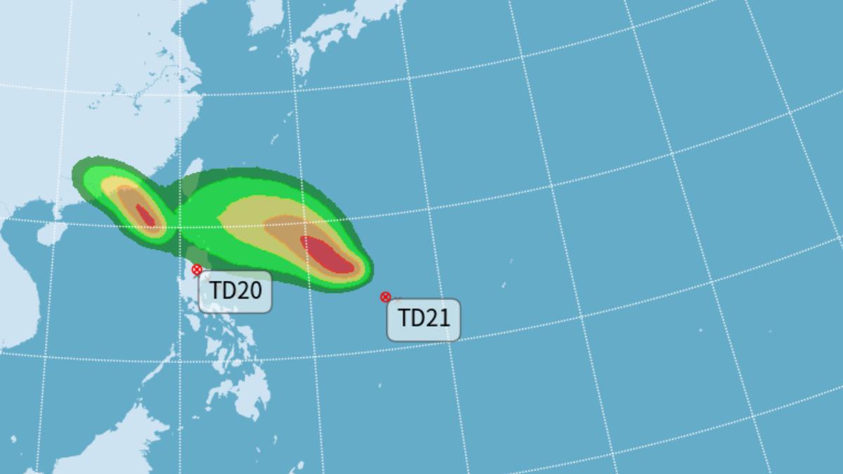
The tropical depression positioned near Luzon Island (呂宋島) in the Philippines will intensify into a typhoon Thursday morning, tracking westward across waters south of Taiwan before striking southern China. The second system, which formed east of the Philippines Wednesday morning, will also reach typhoon strength Thursday morning and continue its northwestward path toward Taiwan, potentially arriving around Monday (Sept. 22).
Weather monitoring page "Look Weather Typhoon" (觀氣象看天氣) reported that a tropical disturbance near Guam strengthened into Tropical Depression 21 Wednesday morning, with potential to become Typhoon Ragasa within 24 hours. Typhoon Mitag's circulation will approach Taiwan closely Thursday and Friday (Sept. 19), delivering rainfall to eastern and southern regions. Northern Taiwan and the Hengchun Peninsula (恆春半島) face strong level 7 gusts, while southwestern seas will experience intensifying winds and waves.
The tropical depression near the Philippines' eastern coast, designated TD20, struck the Philippines early Wednesday morning before moving back to sea. Meteorologists predict it will intensify into the year's 17th typhoon, Typhoon Mitag, as it gains strength over open waters. Experts project the system's central pressure at 985 hPa, with maximum sustained winds reaching 30 meters per second (67 mph) and peak gusts of 40 meters per second (89 mph). ◼ (At time of reporting, US$1 equals approximately NT$30.014)